Recce or reccy. From “reconnaissance,” from the French “reconnaitre,” to recognise. Somehow to recognise in English has become to scout or scope out, and a recce or reccy is familiar to any soldier but also to any fell runner because when there are sometimes no paths, and route choice is a free-for-all, a recce of the race route is a prudent thing to do.
Look up “Holme Moss” and you will find probably accounts from either technology geeks who like the telecommunications mast up there, or cyclists who like to climb up to it, or runners who have run the Holme Moss fell race put on by Holmfirth Harriers, and in their descriptions of it will certainly use the word “beast” or “brutal.” Brutal is overused by runners. Once, in my early fell running days, I used it to describe something I’d found hard, and I was politely corrected. Brutal is best saved for something that is brutal. So I thought perhaps this use of brutal to describe Holme Moss was over-egging.
No. It is brutal. And that was just the recce.
Andy, the race organizer, emailed recently to give an update. He had heard, he wrote, that people had been doing recces of the route, but they wouldn’t be cutting back the undergrowth until two weeks before the race, so to attempt a recce was, in his view, “very brave.”
I read Andy’s email, but I still arranged to do a recce of the whole route with my friends Louise and Marion, on Marion’s birthday. Marion dropped out when she realised she may not be home in time for an early dinner reservation, which meant that a) I had a whole chocolate cake that I had baked for her, and no idea what to do with it (it’s bizarre, but I’ve gone off cake), b) Louise and I could car-share. In hindsight, I wish we hadn’t, and I wish we had thought to take two cars and leave one of them part-way along the race route. You’ll understand why.
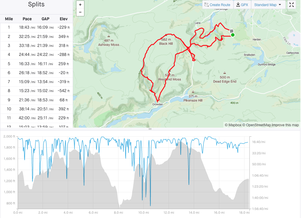
I’d downloaded the GPX of the route onto the OS maps app, which lets you follow a route and tells you when you are off course (though not loudly enough, it turns out). I’d Google-mapped a place to park, about ¾ a mile from the race start, and shortly before the route turns off-road. The route is lollipop-shaped, so we would do three miles of the stick before doing the lollipop. I knew it would be a long day out, but I thought maybe 5 hours.
Ha. Ha. Ha.
I also knew there were lots of downs and steep ups. I’d run part of the route with FRB a couple of years ago but of course had forgotten it. Unless I run something in exactly the same order, it is no use to my memory: I remember different parts from different sections but never in the right sequence.
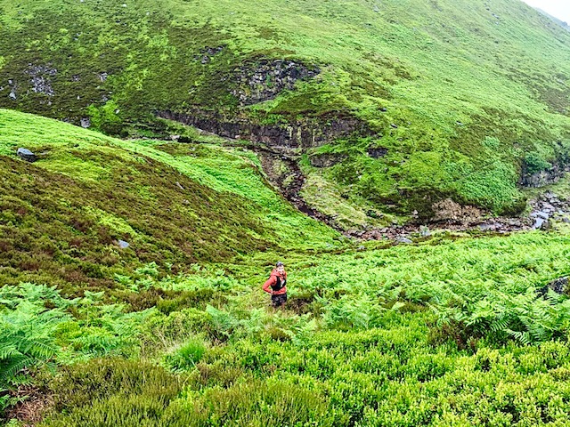
We ran across moorland for a bit, then knew we had to descend. But there was no path or trod or anything visible. We checked the GPX: it was definitely here. We ran on a bit in case we’d got it wrong. Nothing. Back to the trees. We looked down at a steep hillside of dense and high bracken and rocks. Right then.
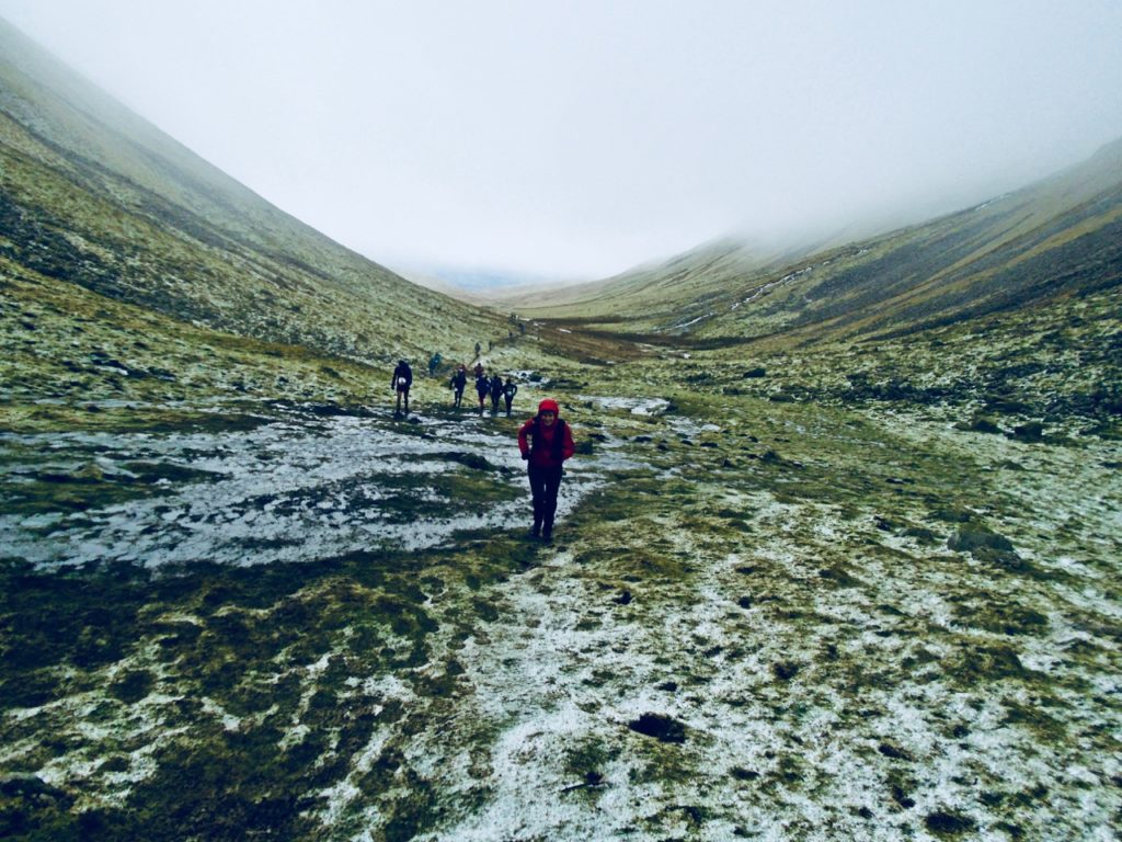
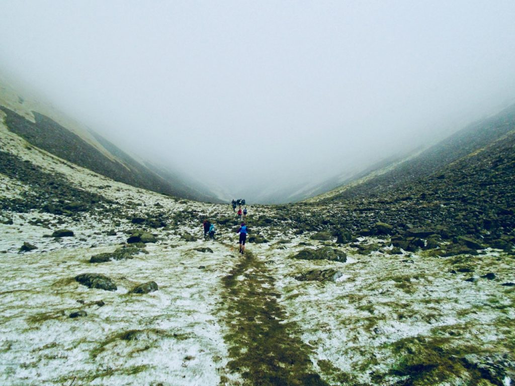
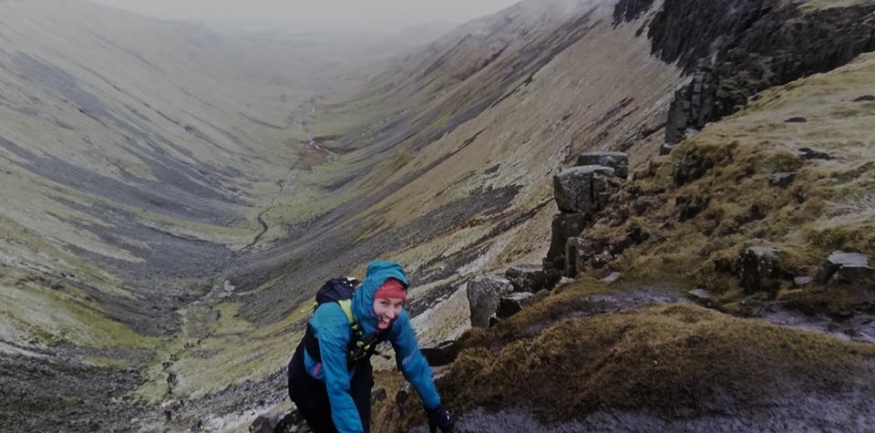
It was not runnable. It was stumble-able and slideable but not runnable. If only I’d known this was the first of many. Over a beck, up the other side and then another hour of desperately trying to find trods, of following ghost trods: slightly darker indentations in the bracken and bushes that sometimes were trods and sometimes were just slightly darker indentations. Forwards, backwards, sideways, check GPX. It’s higher up! It’s lower down! After a while of this, we decided to head in the right-ish direction and get to the next obvious section. There were written instructions to follow but they were sometimes gnomic. The ruined wall was a ruined wall though, and we traced its nubbly rocks, before contouring right. Our destination was Holme Moss car park, and we could see the transmitter there, high up on a hill we had yet to climb. It seemed so far away.
Finally we got there, up to the car park and the road. It is a busy road: I hadn’t realised it was the Woodhead Pass from Yorkshire to Greater Manchester so of course it was busy. The instructions now said to find the drinks station in the upper car park then cross the stile. We got there and saw a stile. That way, said Louise. But the route shows that we go left, I said with conviction. I was emphatic enough that she agreed and we set off a bit further down the road, then crossed before the bend, as that’s what the GPX was showing. There was no obvious path but we’d got used to that by now. And look, after 200 metres, here was our stile. We crossed it to a landscape of no paths in sight, and the road far below us. Onwards, trying to match our line with the GPX, but it was taking us nearer and nearer the road. I was puzzled: why would the route go along the road? But it was definitely going downhill; I knew map contours well enough to see that. Still, it was odd we were heading directly for the.
Oh.
Oh, shit.
On the OS maps app, the route is shown as a red line. But roads are also red. I had been confidently telling Louise to follow the road, while ignoring the subtle “You are off course”. Off course? We were gibbering wrecks in the Mojave Desert when we should have been in the Sahara. I was mortified. I slapped my head. I grovelled. I took full blame. Louise was charmingly forgiving, accepting some of the blame for not having had the courage of her convictions in the upper car park, for not having said, “OK, we disagree so let’s check it.” The trouble is, I did check it, but I was checking the wrong thing. No way were we going back up the hill through path-less tussocks again. The only option was to walk up the road.
No-one walks on this road. I’ve often scorned people running on roads when there is beautiful countryside right next to them, but I had become one of those runners. I switched my watch off because I didn’t want this to be recorded. I didn’t want to remember it. As we climbed, the road curved round. A cyclist was making his way uphill, fast, but a 4WD slowed behind him, as it should on a blind bend. From behind us, half a dozen loud motorbikes arrived, thuggish in their noise. And we watched in disbelief as they overtook the 4WD on the inside, on a narrow road, on a blind bend. It was astonishingly reckless. Shame on you, idiot bikers.
Back to the upper car park, over the correct stile, and – what a relief – an actual path. Soft and peaty and distinct and clear. We ran along it for 400 metres until I thought, I think this is the wrong direction. It was. We had been so giddy about finding a path, we’d set off on the race route but the wrong way round.
Along the way back, we found a pile of human shit to match the pile that someone had thoughtfully left right by the stile. For god’s sake, humanity: if you must shit in the open – and sometimes you must – bury it.
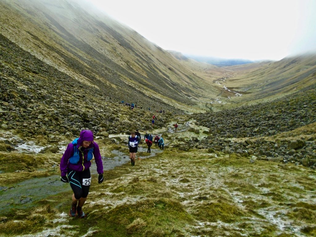
Once again, we set off with no trod in sight. The route now dropped steeply (again) to a gully, then an equally steep climb up to Tooleyshaw Moor. On the far side of the gully, there was the clear line of a trod leading uphill. And once we had crossed and started to climb, we looked back and saw another very clear trod on the side we’d just descended. Ouf.
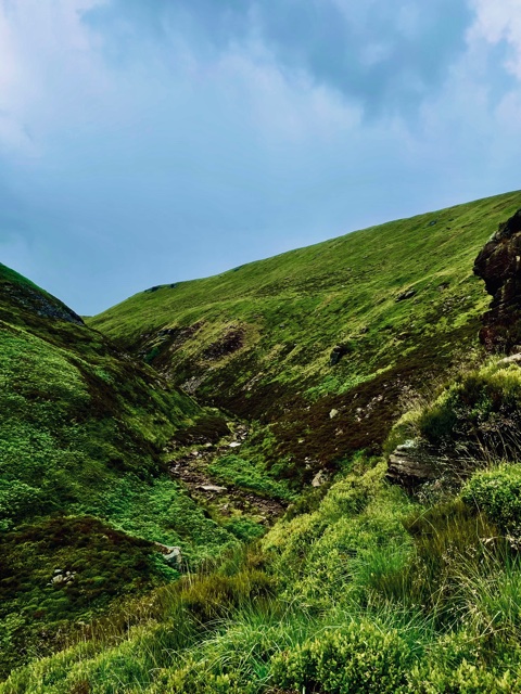
I could see the landscape was beautiful. Every so often at first one of us now and then commented on it. It was unpopulated and stunning.
But soon my thoughts turned elsewhere: to whether I would actually be doing the race, whether my fitness would be up to it, whether I would meet the cut-offs, what with having done hardly any racing for 18 months, beyond the Bradford Millennium Way Relay and then my club’s Kettlewell fell race, where my performance had not been optimal (too much walking). What I hadn’t considered was that so little of the route was runnable. Even the descents were too steep and tussocky for speed, and the climbs were walks or all-fours scrambles.
At least the weather was good. It was warm and overcast but muggy. T-shirt weather. We both thought we had plenty of water, but I’d drunk 500 ml by the time we got to the first beck, and filled my flask. My T-shirt was sodden with sweat on my back. Finally we were running, and I let Louise go ahead, as she is quicker than me on anything that is not a descent. I knew we should hit a footpath – a dotted red line on the map – leading toward Westend moss, but this being Holme Moss race, the footpath was as clear and distinct as all the others. This was beginning to feel like the time that FRB and I were defeated by French maps that showed clear footpaths in dense forest but actually it was just dense forest and the map was either aspirational or historical. At one point, I stood in the foliage and yelled at nature. GORDON BENNET!
It made me feel better but nature didn’t give a fig.
I don’t know if we took the “right” descent to Crowden, but we got there. For a while now I’d been thinking of ice-creams, and God was listening because there was a shop at the caravan park, with an ice-cream sign. Another sign read “cash only” and Louise cursed, but I had my emergency fiver inside my tick card wallet (that’s not code, it’s a clear wallet enclosing a card to remove ticks, which we were probably covered with by now).
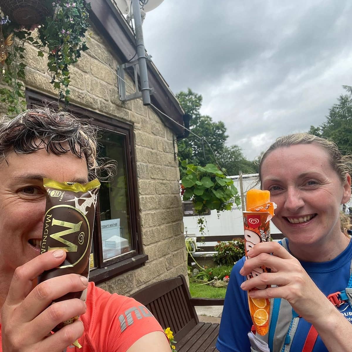
It had taken us more than three hours to cover 8 miles. We deserved an ice-cream. And by eck it was nice.
Back on it. Up the track, over a footbridge, along to another footbridge. No, wait, we’re not supposed to cross another footbridge. Should we have turned earlier? Of course we should. Back 400 metres or so, and up a trod towards Bareholme Moss and Checkpoint 4. I couldn’t remember what the cut-off times were and it would have depressed me to find out, so I didn’t bother checking. I can’t remember the descent to Crowden Great Brook (I’m reading these names off a map, it’s not like I was capable of saying anything but “that beck down there” at the time), but then we could see people! With an umbrella! In a thunderstorm!
We’d had a moment of putting jackets on earlier, but by the time we’d got them on, the raincloud had lifted and buggered off. This time though the rain was set in, and the first thunder rumbles started. Storms when I’m in the open worry me, but I said nothing. It turns out they worry Louise too but she said nothing either, except to express astonishment that someone should be walking along the Pennine Way holding a metal spike over their head, near the highest point in Yorkshire. Like shouting “hey, here is a lightning conductor!” at the lightning.
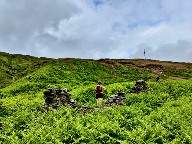
Stupid, but useful for us, because we had visible proof that the Pennine Way was right above us. We knew it was, but to see other life-forms apart from sheep and really upset grouse was strangely comforting. We just had to get up there. More bracken. More tussocks. That sounds so benign. But it was pushing things out of the way while trying not to step into deep holes or turn ankles, while hoping that ticks didn’t hitch onto us, then pushing more things out of the way, then sinking into boggy ground, or hoping the sphagnum moss would hold, then more grooves and ridges and dark unseeable land under the greenery, which may be hospitable to your foot but equally may not. Every now and then Louise would sink into the earth because she seemed to constantly put her feet into deep holes. I started to say, “here’s a hole, Louise, have you gone into this one?”
Our friends Caroline, Martin and Liz were also doing a recce but we didn’t know their route. We’d seen two of their cars at the car park and had tried to figure out what that meant, and decided that they were doing the lollipop, then the stick, then would drive back to the car park. Very sensible. Caroline had been calling us: by then it was past 2pm and we’d started at 9.30. They had finished at Holme Moss car park and “sacked off the rest” and I definitely didn’t blame them. By now I wasn’t sure I’d be doing this race. How much fun would it be? Even if more of the route was flagged and cut back, it still wouldn’t be much more easy going. At one point I said, “this is the felliest route I’ve ever done.” And at another point, “I realise that if this is fell-running” – clambering through impenetrable vegetation for miles – “I’m not a fell runner. I’m a moor runner.”
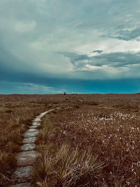
The walkers on the Pennine Way were looking down at us, hopefully in admiration but probably more in bafflement. Caroline & co, we later found out, didn’t bother with this scramble, having had enough, and had run along the beck. But I wanted a clear footpath. I wanted visibility and no holes. And we got it. Not only that, but there were flagstones! I know plenty of off-road runners dislike flagstones. They don’t go well with aggressive fell shoes. But these flagstones were like running on cotton wool.
10 miles in; nearly five hours.
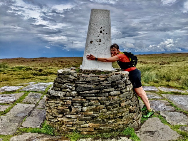
At the top, we’d fuelled with half a sausage roll each. And we both managed to run pretty well considering how long we’d been out. A mile or so later, there was the glorious sight of a glistening white trig. Black Hill, nearly 600 metres above sea level. I was so pleased to see it, I hugged it. I was pleased to see it because it meant we were on the home stretch. Technically, this was true, as we had rounded the lollipop and were coming back to where we had started it. But we could also be out for hours yet.
At this point, we knew that Holmfirth Harriers had asked us not to run on the race route back to Checkpoint 7/1 at Holme Moss car park, because it passed over eroded peat landscape and Natural England was trying to mend it. I honestly don’t know at that point whether we managed to stay off it, because we ended up wrong once again, on the wrong side of the clough, with the transmitter, our holy grail, on the other side and looking like it was a long way away. So, another descent through dense greenery, another crossing of another beck, another climb up another steep side. At the top, a runner passed us, looking fresher than we were. Anyone would look fresher than we were. Back to the stile, then the car park, then the next car park. And as we approached, oh my goodness, is that an ice-cream van?
Two ice-creams in one day? Yes. God, yes. Louise bought two 99s, and we looked over to the west and saw black, black clouds, and kept our jackets on. I’d suggested that we avoid the difficult “stick” part back to the start, the three miles that had taken us an age, but that we walk down the road then on a clear track through the forest. We set off walking. By now it was 4pm. We’d been out nearly seven hours. FRB had been checking in, but I hadn’t told him I’d chosen this route back, which was a shame, because afterwards he reminded me that there is a trod back to the forest, off-road, that isn’t on the map but does exist because we had taken it when we were last here.
The sky turned black, and the downpour began along with loud thunder and visible lightning. There we were, two sodden women eating delicious 99 cones, walking down a busy A road in a significant storm. A sight.
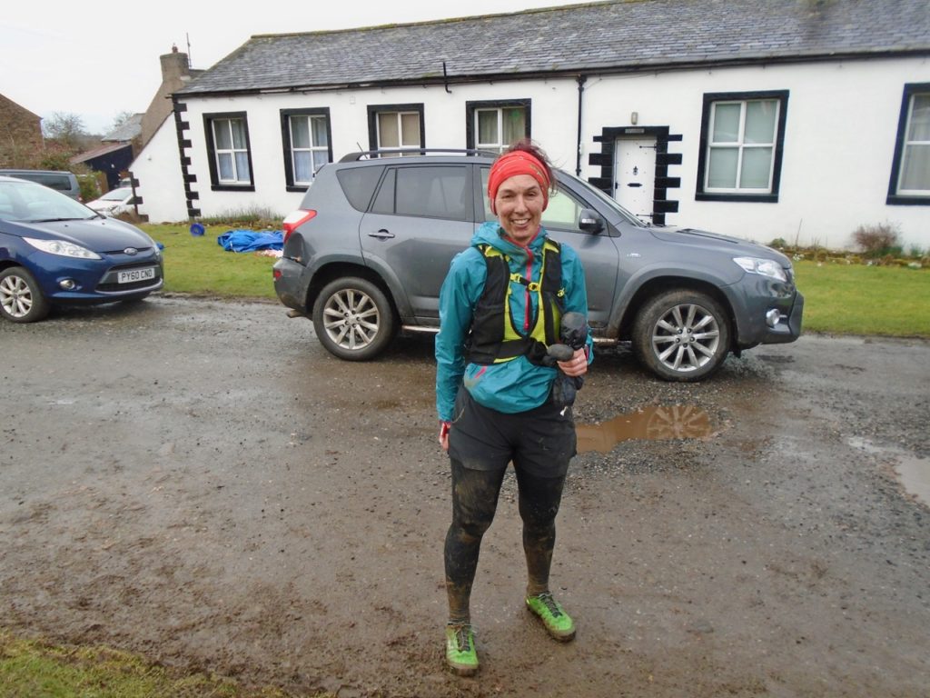
I thought we’d only be on the road for a bit, but it was a much longer bit than I’d estimated. Later we both admitted we’d been scared by the fact that the thunderstorm was directly above us. Probably we were both silently counting, though I don’t know whether that’s a myth, that seconds between lightning and thunder equal the number of miles away the storm is. Soon after we set off, the ice-cream van passed us, chased away by the time of day and the colour of the sky. After about a mile we turned off onto a forest track, and we were both so wet by now we had rainwater in our pants. We tried to run for a bit but by now things hurt and ached and groaned. Oddly, my problematic left knee was fine but now my right one hurt. So without agreeing to, we settled on walking. Even the track took far longer than I’d hoped and in normal times I’d have enjoyed the quiet forest, but this was not normal, I was both dulled and shocked by how long we had been out and how difficult it had been. And I was a bit tired. We had fuelled and drunk plenty, but neither of us had expected to be out for this long. We still had a climb up to the road where the car was, but eventually the track turned into a lane, and at the end of the lane was a tarmac road and there was my car and I couldn’t quite believe it. Dry clothes, tepid tea, more sausage rolls and my mother’s bakewell tarts and we both felt better.
I got home at 8pm, ate a kilo of pasta, foam-rolled, stuck my legs up the wall (an excellent form of recovery), fell asleep 90 minutes later, and slept for eleven hours.
Louise: thank you for being such great company in adversity. We had done nearly 19 miles instead of 16, and had been out for nearly nine hours, when we had planned for five or six. Yes, Strava, it definitely was “a massive effort.” Will I do the race? It depends whether I can forget the scrambling, wading, cursing, stumbling, faltering, and endless double-backing and remember instead the glorious landscape, the moors, the becks, the deep green of everything, the bilberries, the curlews, the views. To be decided.